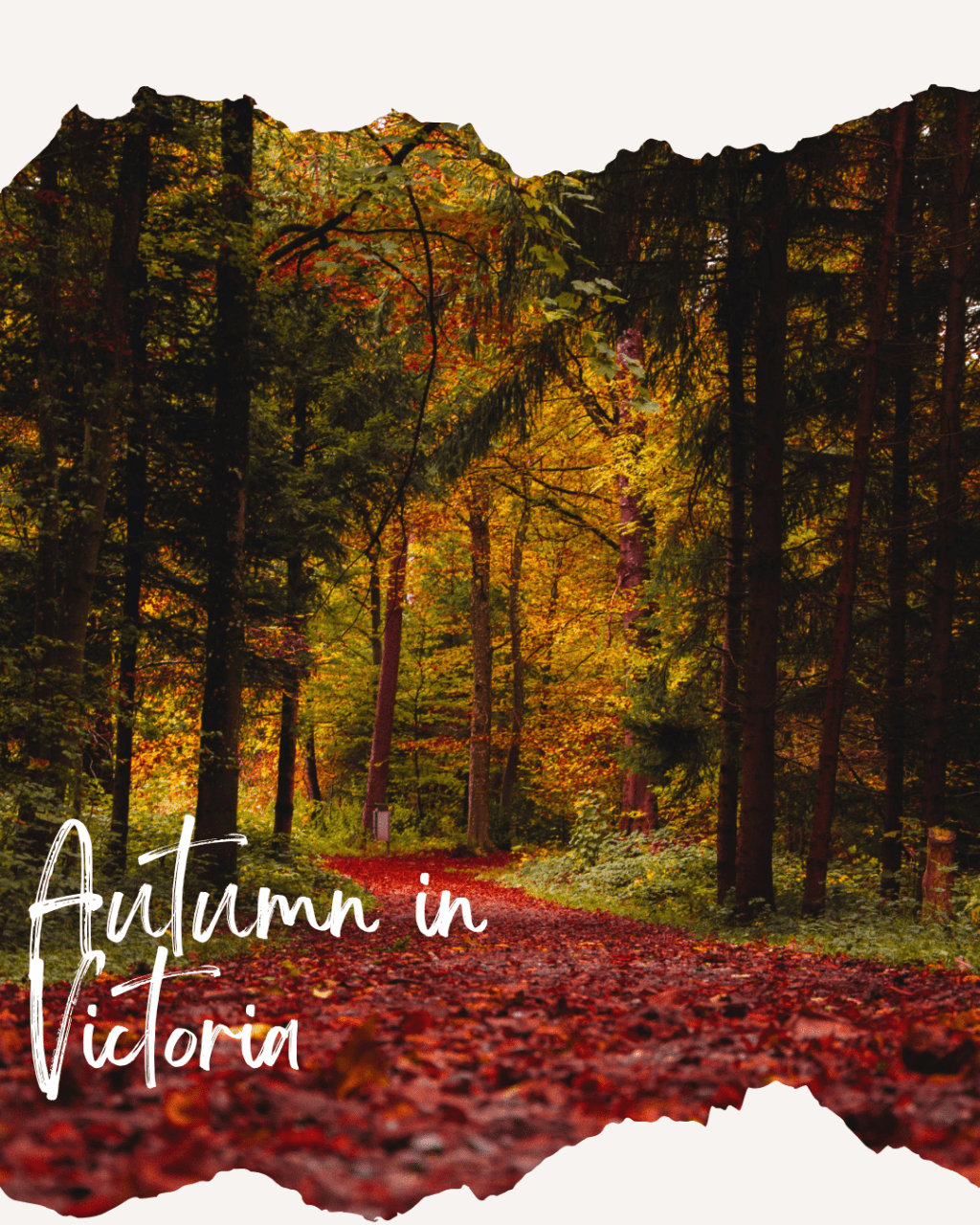
This is the autumn escape most Melburnians drive straight past on their way to the coast. They miss out farmland, trestle bridges, deep forest and a town with more history than it gets credit for.
Route Guide:
From Melbourne: 120 km
Melbourne – Drouin / Garfield (coffee & bakery) – Yarragon (Heritage village & the Bakery) – Moe (Botanic gardens) – Noojee (Trestle bridge, Toorongo Falls & Noojee Pub) – Forest detour – Neerim South (beautiful backroads) – Warragul
The Princes Freeway/ M1 from Melbourne is efficient but scenically blah. But the drive earns its character when once you exit it. The suggested approach is to join the Monash Freeway east and take the Drouin exit, which brings you off the highway before Moe and onto the slower, more revealing country roads of the hinterland. From here everything happens at a different pace.
On the way to Moe
Garfield & Cannibal Creek Bakehouse
The little railway town of Garfield, just north of the highway, is worth the five-minute detour for one reason: the Cannibal Creek Bakehouse.
Baking from a 100-year-old wood-fired scotch oven, this is sourdough of genuine craft. Its dense and properly fermented with a crust that cracks when you break it. Get them to add the 18-month-aged Gippsland cheddar on the toasties!. The adjacent Luna’s Garfield café, from the same team, does one of the best big breakfasts in western Gippsland. A proper start to a proper day out. You can opt to do the Mt Cannibal Walk (2.3 km loop, 45 mins) and pick up wine some award-winning, single estate cool climate from Cannibal Creek Winery.
We are in Berwick and this was a surprise find while we were on our travels exploring this gorgeous side of Melbourne South-East.
Yarragon: The Artisan Village
Twelve kilometres east along the highway, the small community of Yarragon operates as something between a village and an art colony. Known for its specialty shops including antiques, galleries, textiles, handmade goods and a bakery; it’s a good early stop if you want to browse at leisure.
The main street retains much of its early character. Yarragon also marks the point where the farming country opens up properly to the east, with views across rolling pasture toward the timbered ridgelines of the Baw Baw ranges rising to the north.
Moe
Local Legend: The town the swamp built and coal kept
The town of Moe derives its name from the Boonwurrung word for ‘marshy place’. The area west of the present town was originally an extensive swamp bounded by the Great Dividing Range to the north and the Strzelecki Ranges to the south. The Boonwurrung people knew the importance of the swamp for its food resources.
Learn More
European settlers arrived seeking gold in the 1850s, using the small Narracan Creek settlement as a stopping point on the track north to the Walhalla goldfields. The railway arrived in 1878, the town was surveyed in 1879, and for the next century Moe’s destiny was shaped by coal. The Latrobe Valley sits above one of the world’s largest brown coal deposits; a resource so vast that in 1977 the State Electricity Commission estimated that 50 years of intensive use had consumed under 1% of proven reserves.
The power stations that followed transformed not just the region’s landscape but its identity, drawing waves of workers and migrants that gave the valley its particular working-class character. The Yallourn power station, the first major plant in the valley, began feeding electricity to Melbourne in 1924. An entire planned town of Yallourn was eventually demolished from the 1970s to 1982 to mine the coal beneath it. Those townspeople’s lives are preserved, in a way, at Old Gippstown and you can learn more about it at https://localvic.com/2023/08/07/exploring-timeless-treasures-at-old-gippstown.
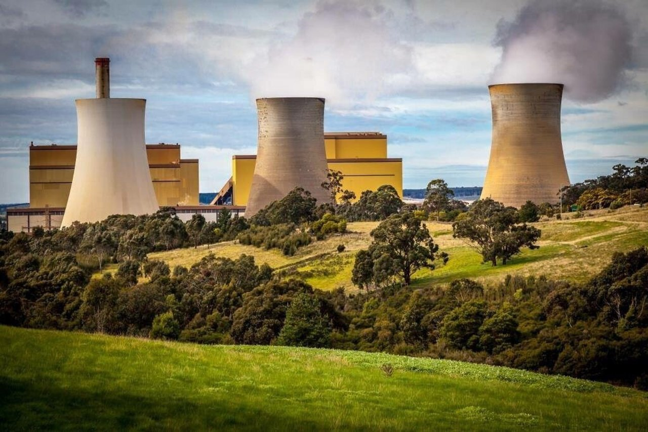
Moe today is a city that wears its industrial past honestly. It is not a heritage-polished tourism town, and that’s part of its appeal. The street art commission known as the Bechaz murals, concentrated around the botanical gardens and rail trail, are among the most compelling large-scale works in regional Victoria. It is such a dramatic spray-paint illustrations that it can be glimpsed from the train window through Morwell and explored properly on foot in Moe.
Moe Botanical Gardens on Narracan Creek
Located on Botanic Drive, just east of the town centre, the 16-hectare gardens follow the meandering Narracan Creek and are best entered from the tennis club car park (better signage and parking than the main entrance off the highway). The walking path is flat and winds through a mix of native and exotic trees that produces a layered autumn palette of amber, copper and dark green. There is a small suspension bridge over the creek that adds a pleasing note of adventure, and the path connects directly to the Moe–Yallourn Rail Trail.
Narracan Creek was once a genuine fishing spot and locals still recall it providing trout, eel and blackfish well into living memory. It’s quieter now, but the creek corridor is undeniably beautiful especially during autumn and winter months when mist sits in the gully and the leaf litter covers the paths in deep colour.
Old Gippstown Heritage Park
Forty-seven relocated historic buildings from across the Gippsland region, assembled on 8 acres of landscaped gardens at the western end of town. The structures span the 1840s to 1930s and include the 1850 Bushy Park homestead built by Gippsland explorer Angus McMillan (on the National Trust Register), a prefabricated iron house imported from Britain in 1853, a general store, a deconsecrated Anglican church, and the Coach House with horse-drawn carriages and agricultural machinery.
Most significantly for the Latrobe Valley story, Old Gippstown preserves the social world that coal and power generation created and then disrupted. The town of Yallourn which was demolished from the 1970s onward to mine the coal beneath it contributed several of its buildings here, giving the complex an elegiac quality. In autumn, the gardens surrounding the heritage precinct are at their best: old trees with deep canopies turning gold, quiet paths, almost no crowds on weekday mornings.
Allow 2 hours to enjoy this fascinating space.
Moe to Noojee (35 km up into the hills)
From Moe, the C426 Noojee Road heads north and east through agricultural land that changes character visibly as you climb. The flat flood-plain country gives way to rolling hills, then to steeper terrain as the road approaches the foothills of the Baw Baw range. This 35-kilometre stretch is one of the best backroads drives in West Gippsland in autumn. It has gentle bends, veteran trees on the roadside, cattle in paddocks behind post-and-rail fencing, and the occasional dairy operation with the particular green smell of the valley after rain.
We love travelling and exploring this region and always find something new to enjoy and explore.
Noojee
The town itself is small with a café, a popular pub, a heritage centre with a J-class steam locomotive in the yard, and a general store that doubles as a local social hub. The Noojee Hotel and ToolShed Noojee are the kind of country pubs every regional drive needs to end at. Explore the Noojee Trestle Bridge which was the last of seven identical bridges on the old Warragul–Noojee timber railway. The bridge burned down on Black Friday 1939 and was rebuilt the same year. The other six are all gone. It was fully restored again in 2022.
From Noojee, a 20-kilometre drive east on the Toorongo Valley Road leads to one of the most accessible cool temperate rainforest experiences in West Gippsland.
Toorongo Falls: 20 Minutes of Rainforest
From Noojee, a 20-kilometre drive east on the Toorongo Valley Road leads to one of the most accessible cool temperate rainforest experiences in West Gippsland.
The falls themselves are tiered and impressive rather than dramatic, but the real pleasure is the quality of the forest on the way. In autumn, the myrtle beech in the gully turns a warm copper-gold, and the forest floor becomes a carpet of fallen leaves over the fern roots. The campground on the river bank is a lovely overnight option if the drive is being extended into two days.
Toorongo Falls Circuit Walk (Grade 2) includes Toorongo Falls and Amphitheatre Falls. The track follows the Toorongo River through dense native bush, rising gently to the falls with tree ferns overhead and the sound of fast-flowing water throughout.
The 2.2 km circuit ·takes about 90 min and you can take dogs on lead. Basic facilities including toilets and picnic tables at the day visitor area.
One planning note: Toorongo Falls can be very busy on sunny spring weekends with cars parked for kilometres on the access road. So choose a weekday or early morning when it is virtually deserted.
Trails of the Hinterland
| Walk | Distance | Time | Notes | Grade |
|---|---|---|---|---|
| Moe Botanical Gardens loop | ~3km loop | 45 min | Creek-side path through native and exotic trees. Connects to Rail Trail. Flat, suitable for all. Peak autumn colour April–May. | Easy |
| Moe–Yallourn Rail Trail | 8km one way | 2–2.5 hrs | Starts at Botanical Gardens. Flat path past bushland, rural estates, Lake Narracan to Yallourn power station. Return same way or arrange transport. | Easy |
| Noojee Trestle Bridge Walk | 3km each way | 1.5–2 hrs return | From Noojee Heritage Centre along old railway line. Easy, flat, family-friendly. Bridge at 2km from trailhead. Can extend beyond bridge for further forest exploration. | Easy |
| Toorongo Falls Circuit | 2.2km loop | 90 min | Both Toorongo and Amphitheatre Falls. Cool temperate rainforest, river crossings, tree ferns. Uphill to falls, steady descent back. | Easy |
| Rokeby Neerim Rail Trail | ~15km one way | Half day | Another section of the old Noojee railway line. Rolls through farmland and small Gippsland villages. Mostly flat. Great for cycling as much as walking. | Easy |
| Edward Hunter Heritage Bush Reserve | Various trails | 1–2 hrs | 58ha of protected bushland off Coalville Road, Moe. One of the largest remaining pre-European native vegetation patches in the Latrobe Valley. Rich in birdlife. Multiple trail options. | Easy |
The Backroads Loop: Neerim South to Warragul
The return to Melbourne via Warragul offers one of the best backroads options in the region. From Noojee, rather than retracing the C426, take the quieter roads south through Neerim South and Neerim Junction with small farming communities in the foothills that most travellers never visit.
The roads cross shallow creek valleys, pass century-old farmhouses, and move through patchwork paddocks that in autumn are the particular deep green of Gippsland dairy country with the fallen-leaf season layering amber and ochre across the hedgerows and roadsides.
Jindivick Road and the hill country southwest of Noojee
The high point of the Neerim South to Warragul backroad, around the Jindivick area, gives elevated views across the Gippsland plains in the late afternoon. The road south from Neerim South through Jindivick descends through the foothills via a series of sweeping bends. Pull over on the high sections for views across the Gippsland plains stretching south and east and on clear autumn days the view extends to the Wilson’s Promontory ranges on the horizon. The light in the late afternoon comes in low from the northwest and turns the paddocks and tree lines an extraordinary gold-amber.
You can visit the artist’s garden at Broughton Hall in Jindivick. It is a private garden that opens occasionally to visitors. It is the kind of deeply personal, eccentric country garden that exists only where someone has been tending a particular landscape for decades. The layers of planting, unusual specimens and a view across the ranges is lovely. Not always open, but worth investigating before the drive.
We are currently exploring this area and often find ourself driving around and enjoying the quintessential West Gippsland pastoral scene with a little picnic and coffee.
Travelling by Train
V/Line Traralgon/Gippsland service from Southern Cross or Flinders Street stops at Moe (approx. 1 hr 40 min). The Botanical Gardens and Old Gippstown are walkable from the station. Noojee requires a car or taxi from Moe.
V/Line also stops at Warragul and Drouin if building the loop in stages.
