Route Guide:
Melbourne – Calder Fwy – Harcourt – Castlemaine – Chewton – Maldon – Newstead – Bendigo – Return via Calder or Midland
In 1851 alluvial gold was discovered in Forest Creek at what would become Castlemaine, and within weeks tens of thousands of people had transformed a wilderness into the most densely populated square mile in Australia. The wealth that followed built two of Victoria’s finest provincial cities – Castlemaine and Bendigo. Both were built in a style that no working mining town had any right to produce. Wide boulevards, sandstone civic buildings with classical facades, botanical gardens designed to rival Melbourne’s, Gothic cathedrals visible from five kilometres away.
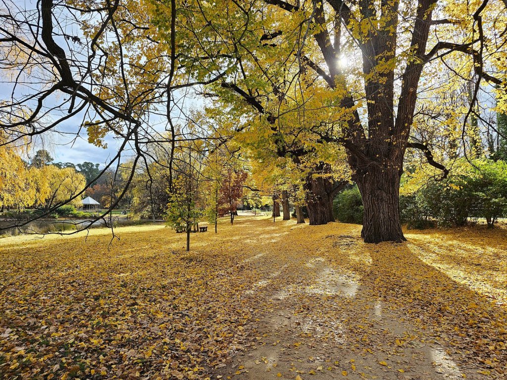
In autumn, when the European elms and oaks planted by those prospectors turn copper and gold, the whole landscape glows like the thing it was originally built to celebrate.
Castlemaine feels creative, slightly bohemian, and comfortably unhurried. Its a town where vintage storefronts, artists’ studios and good coffee set the rhythm of the day. Bendigo, in contrast, rises with grandeur with its bold architecture, wide boulevards and a metropolitan confidence shaped by its gold rush legacy.
On their own, each offers a distinct experience. But together, in a single day, they create a striking contrast that is intimate and expansive, artisanal and monumental. That interplay makes this route one of the most rewarding autumn road drives from Melbourne, where the journey between the two is just as beautiful as the destinations themselves.
The Calder Road: Orchards, Bluestone & the Harcourt Valley
The Calder Freeway from Melbourne is fast and functional. The landscape becomes interesting at the Malmsbury exit, where the bluestone viaduct over the Coliban River (1859, still carrying rail traffic) sits in a valley of planted willows and open pasture that is one of the most quietly beautiful views in Central Victoria. Malmsbury itself, with its stone buildings and ancient-feeling village structure, is worth ten minutes of your morning.
Continue north to Harcourt. The Harcourt valley is apple country and Victoria’s most celebrated orchard region, where the combination of cold nights, warm days and granite soil produces apples of exceptional quality. In autumn the orchards are at harvest, the roadside stalls are stocked, and the valley below Mount Alexander is suffused in the particular warm light of the season. Stop at the roadside stalls for apples, pears and cider. This is the best produce purchase of the drive.
Castlemaine to Bendigo: The Backroad Loop
The direct route from Castlemaine to Bendigo via the Midland Highway takes 40 minutes. The backroad loop via Chewton, Maldon and Newstead takes 90 minutes and is an entirely different experience. The following describes the recommended loop and adding one hour to the day covers three of the most atmospherically distinct places in the Goldfields.
Chewton – Ghost Landscape of Forest Creek (7 km from Castlemaine)
The small historic township of Chewton sits within what was once the world’s most densely populated square mile. The Forest Creek goldfield at Chewton produced some of the richest alluvial deposits in Australian history.
Today the landscape is a palimpsest of that intensity: post office hill, stone chimney remnants, denuded reef lines, mine shaft foundations, the Cornish chimney on Burns Hill, and the site of the original Chewton Railway Station. All these stand within a 22-hectare community and a managed reserve that has no formal walking track, just open exploration through the archaeological landscape. The Monster Meeting site, where in December 1851 ten thousand miners gathered to protest government policies, is accessible from the car park. In autumn, this ungroomed, atmospheric remnant landscape is extraordinarily photogenic.
Maldon – Australia’s First Notable Town
Maldon was proclaimed Australia’s first notable town by the National Trust in 1966. This designation has kept its 19th-century streetscape essentially unchanged. The main street is lined with stone buildings, old hotels and shopfronts that look less restored than simply never demolished. The Poppet Head tower lookout, opened in 1924 and providing panoramic views across the region to Mount Macedon, Mount Alexander and the Grampians, is a 15-minute walk.
The Victorian Goldfields Railway is a volunteer-operated steam heritage train connecting Maldon and Castlemaine and runs on selected weekends. The train provides one of the finest autumn travel experiences in Victoria with open carriages through the box-ironbark country between the two gold towns.
Newstead – The Loddon River Town
Newstead sits on the Loddon River on the Pyrenees Highway between Castlemaine and Maryborough. A general store, two pubs, a café, a community art hub, and a butcher famous for Bull Boar sausages: this is a town with genuine local character rather than tourist polish.
The Loddon River at Newstead in autumn, lined with large River Red Gums dropping leaves into the current, the water running clear and cold is one of the quietest and most beautiful riverside scenes within two hours of Melbourne.
Bendigo
Local Legend: The Park Built on the Mine — and the Fruit Bats Nobody Expected
Rosalind Park occupies a block in the heart of Bendigo that was, before the gold rush, a grassy woodland with a chain of permanent fresh water ponds — an important food and water source for the Dja Dja Wurrung people.
The 1851 gold rush transformed the site into a government camp, then a field of shallow shafts and mullock heaps. By the late 19th century, as Bendigo’s gold wealth matured into civic ambition, the mine site was converted into a public park and heritage gardens. What nobody planned for was the colony of grey-headed flying foxes (now thousands strong roost in the park’s tall trees, particularly in the cooler months). In the late afternoon they begin launching from the canopy in waves, their wingspan up to a metre across, filling the sky above Pall Mall in one of the most unexpected urban wildlife spectacles in Australia.
Rosalind Park & the Poppet Head Lookout
Added to the Victorian Heritage Register in 2000 for its historic, archaeological, aesthetic, scientific and architectural significance, Rosalind Park is one of the most layered public spaces in regional Victoria. The park’s autumn spectacle with its canopy of ancient elms, oaks and Queensland brush boxes turning gold against the sandstone of the surrounding buildings is described by locals and visitors alike as a “buttery,” warm transformation that persists well into May.
The Poppet Head Lookout at the park’s highest point is a tower constructed from an original gold mine shaft head frame. The view from the upper platforms over Bendigo’s wide streets and Victorian civic architecture, with the Cathedral spire rising above the canopy, is excellent on clear autumn mornings. The conservatory gardens are housed in a glass structure beside the main park and the Yi Yuan Chinese Garden (walled, Beijing Summer Palace-inspired) add cultural layers that reward time in the park beyond a quick walk.
Practical: in the late afternoon, as the flying foxes become active overhead, the park fills with an extraordinary sound — tens of thousands of fruit bats launching from the canopy. This is worth timing your Bendigo visit around. Plan to be in the park at 4:30–5pm.
Pall Mall & Sacred Heart Cathedral
Bendigo’s main street, Pall Mall, is one of the finest examples of Victorian colonial civic architecture in Australia. The buildings on both sides has banks, hotels, the post office that now houses the Visitor Information Centre, the law courts and the town hall. All were built with the absolute confidence of a city that believed its gold wealth would never end. Walk the length of it slowly. The quality of the stonework, the ambition of the facades and the sheer scale of the civic investment is remarkable for a regional city.
Sacred Heart Cathedral, begun in 1896 and still unfinished in sections, is the third-largest cathedral in Australia and was built to be visible across the goldfields as a statement of Bendigo’s significance. The Gothic Revival spire rises 94 metres its spire is visible from five kilometres in every direction! The cathedral is open to visitors and worth entering for the interior stonework and stained glass. The best exterior photograph is from below, looking up from the streets to the west in the late afternoon, when the low autumn sun catches the sandstone and turns it amber-gold against a deep blue sky.
Walks & Trails
| Walk | Distance | Time | Notes | Grade |
|---|---|---|---|---|
| Castlemaine Botanical Gardens loop | 2–3km | 45–60 min | Flat perimeter path around the gardens and lake. Heritage tree signage throughout. Multiple bench stops. Suitable for all abilities. Dogs welcome on lead. | Easy |
| Buda Heritage Garden walk | ~1km | 30–60 min | Self-guided stroll through 3 acres of intact heritage garden. Entry fee. Opens at noon. Picnics welcome on the lawn. | Easy |
| Castlemaine Heritage Walk | ~3km | 1–1.5 hrs | Self-guided walk taking in the 1857 Market Building, Theatre Royal, Buda, grand public buildings and wide heritage streetscapes. Maps available from the Market Building Visitor Centre. | Easy |
| Chewton Forest Creek archaeology walk | ~2km | 45–60 min | Unformed exploration through 22.6ha gold-rush landscape. No marked trail — self navigation. Locate stone arch, Cornish chimney, mine foundations and old race lines. Maps available at entry. | Easy |
| Rosalind Park & Poppet Head | ~2km | 45–60 min | Lower gardens, conservatory, Yi Yuan Chinese Garden, and climb to Poppet Head Lookout. Uphill section to the lookout is short but steep. Panoramic views from the top platform. | Moderate |
| Castlemaine to Maldon Trail | 17.7km one way | Half day cycling | Parallel to the Victorian Goldfields Railway. Through bushland and farmland past gold-era historical sites. Best cycled rather than walked. Hire bikes available in Castlemaine. | Moderate |
Location & distance guide to Castlemaine & Bendigo
Melbourne to Castlemaine: 120 km
Castlemaine to Bendigo: 50 km
The return route option
The most direct return is the Calder Freeway south from Bendigo — 150 km, 90 minutes. The scenic option follows the Midland Highway south from Bendigo to Castlemaine, then south via Elphinstone and Malmsbury to the Calder adds 30 minutes but covering more of the box-ironbark country and the bluestone valley at Malmsbury.
The Harcourt Valley exit on the return is also worth a stop for evening apple purchases at the roadside stalls, which often have pressed cider available to take home.
By Train
V/Line express from Southern Cross to Bendigo in 90 minutes, or to Castlemaine in 80 minutes. The loop is possible by train if you book return from Bendigo and catch the local service back to Castlemaine.
Both Castlemaine and Bendigo sit on the Country of the Dja Dja Wurrung people, who have cared for this landscape since before the gold was discovered beneath it.
The permanent exhibition ‘Boorp Boorp Boondyil’ in Castlemaine’s Market Building focusing to pass knowledge on to our children and offers interactive engagement with Dja Dja Wurrung language, stories and art. It is one of the finest cultural heritage installations in regional Victoria and worth allowing 30 minutes for at the start of the day.
